GeoSpy
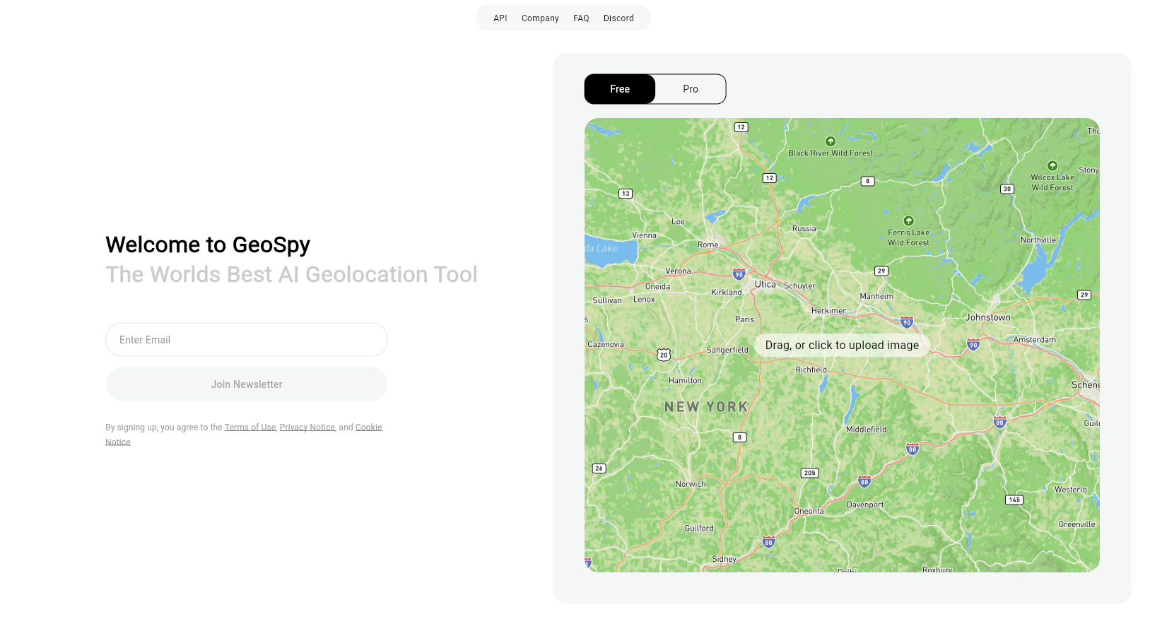
GeoSpy AI is a sophisticated geospatial intelligence tool developed by Graylark Technologies. This cutting-edge tool leverages artificial intelligence to analyze and interpret images, satellite imagery, and spatial data. Users can upload photos and quickly receive estimates of where the images were captured, along with detailed location information. GeoSpy AI is designed to cater to a wide variety of applications including open-source intelligence (OSINT), journalism, law enforcement, environmental monitoring, and urban planning.
The tool employs advanced AI algorithms to extract and analyze visual features from images, such as vegetation, architecture, and landmarks, to determine the geographical location. GeoSpy AI provides estimated coordinates, city/country information, and explanations for its predictions. For professional or advanced usage, GeoSpy Pro offers enhanced capabilities tailored for law enforcement, government agencies, journalists, and enterprise use cases.
GeoSpy AI offers both free and professional versions, with integration capabilities through API access, making it a versatile tool for incorporating geolocation functionality into other tools and workflows.
Highlights:
- AI-Powered Photo Analysis
- Detailed Location Predictions
- Integration Capabilities
- Professional Version for Enhanced Capabilities
- Wide Range of Applications
Key Features:
- AI-Powered Photo Analysis
- Detailed Location Predictions
- Integration Capabilities
- Professional Version
- API Access
Benefits:
- Powerful AI-driven geolocation capabilities
- Useful for a wide range of professional applications
- Offers both free and advanced versions
- Integration options for various tools and workflows
- Enhanced capabilities in GeoSpy Pro
Use Cases:
- OSINT Investigations
- Law Enforcement
- Journalism
- Disaster Response
- Urban Planning
This content is either user submitted or generated using AI technology (including, but not limited to, Google Gemini API, Llama, Grok, and Mistral), based on automated research and analysis of public data sources from search engines like DuckDuckGo, Google Search, and SearXNG, and directly from the tool's own website and with minimal to no human editing/review. THEJO AI is not affiliated with or endorsed by the AI tools or services mentioned. This is provided for informational and reference purposes only, is not an endorsement or official advice, and may contain inaccuracies or biases. Please verify details with original sources.


Comments
Please log in to post a comment.