idomaps
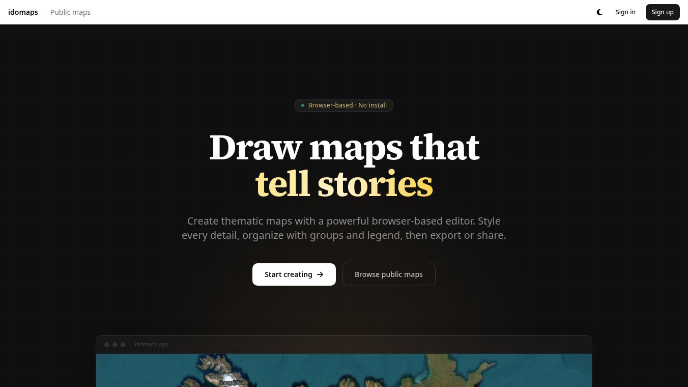
idomaps is a web-based tool that lets people create detailed thematic maps without needing special software or training. It runs entirely inside your web browser, so you do not have to install any plugins or download heavy desktop applications. This makes it easy for anyone to use, even those who have never worked with geographic information systems before. The platform is designed to help users tell stories through maps by allowing them to draw, style, and share visual content quickly.
Benefits
idomaps offers several key advantages for map creators. First, it provides precise drawing tools that support polygons, lines, points, text, arrows, circles, and rectangles. This allows users to create complex shapes and annotations with high accuracy. Second, the tool includes rich styling options. Users can change colors, adjust opacity, apply fill patterns, and choose from a built-in icon library to make their maps look professional. Third, the software helps organize large projects. It features groups that let users sort features logically and a collapsible workspace to keep the editing area clean. A built-in legend system ensures that map elements are presented consistently. Finally, the tool supports multiple base maps like satellite imagery and topographic views, giving users flexibility in how they visualize their data.
Use Cases
idomaps is useful for a wide range of people and situations. Educators can use it to create maps for history or geography classes, showing topics like trade routes or migration paths. Travelers and outdoor enthusiasts can build custom guides for road trips or hikes, adding markers and photos to help others navigate. Researchers and journalists can illustrate data stories or fieldwork by embedding interactive maps into articles. Content creators such as bloggers and YouTubers can produce beautiful visuals to support their videos or newsletters without spending money on expensive software. Local governments can map zoning plans or public projects for their websites. Museums and cultural organizations can display archaeological sites or historical events in engaging ways.
Pricing
No pricing details were found in the provided information.
Vibes
No reviews or testimonials were found in the provided information.
Additional Information
No information regarding funding, partnerships, or specific achievements was found in the provided text.
This content is either user submitted or generated using AI technology (including, but not limited to, Google Gemini API, Llama, Grok, and Mistral), based on automated research and analysis of public data sources from search engines like DuckDuckGo, Google Search, and SearXNG, and directly from the tool's own website and with minimal to no human editing/review. THEJO AI is not affiliated with or endorsed by the AI tools or services mentioned. This is provided for informational and reference purposes only, is not an endorsement or official advice, and may contain inaccuracies or biases. Please verify details with original sources.
Other Interesting AI Tools


Comments
Please log in to post a comment.